
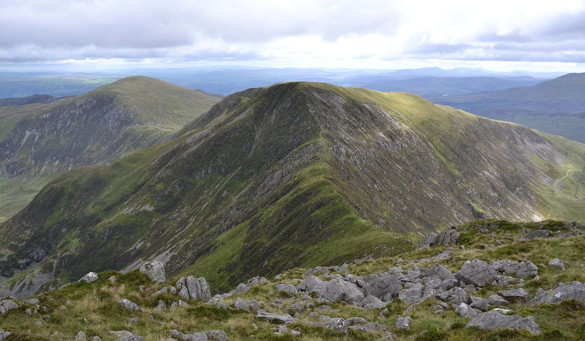
Essential Navigation Skills For Misty Hill Days
Why cloud changes everything
On a clear day on the fells most of us navigate by eye. You see the col ahead, the wall on the skyline, the curve of the ridge, and the map becomes almost decorative. Then the cloud comes down and that entire layer of information vanishes. What is left is your map, your compass, your pacing and your ability to read the shape of the ground under your boots.
That sounds austere, but it is liberating. Those four things work in exactly the same way whether visibility is five kilometres or five metres. Most navigation errors in the British hills are small ones — a hundred metres off line, a spur taken instead of a re-entrant — that become serious because they compound quietly over an hour or two. The skills below are about catching those errors early, while they are still trivial.
Pacing: knowing exactly how far you have walked
Pacing is the quiet skill that turns a bearing into a position. Distance is the half of navigation that people neglect, and it is the half that tells you whether the feature you just passed was the one you thought it was.
Count double paces — that is, every time your left foot lands. Before you rely on it, calibrate on flat ground: measure out 100 metres on a track or a quiet road, walk it at your normal hill pace and count. Most people land somewhere between 55 and 70 double paces per 100 metres. Add roughly ten per cent for gentle uphill and up to twenty per cent on rough, tussocky or steep ground; subtract a little on firm downhill.
Pair pacing with timing as a cross-check. A reasonable working figure is four kilometres per hour on flattish ground with a pack, plus about one minute for every ten metres of ascent. If your pace count and your watch agree, you can trust the answer. If they disagree, stop and work out why.
Practise until you can count while holding a conversation, and use a tally counter or move pebbles from one pocket to another for the hundreds of metres. In thick mist, counting is often the only thing keeping you honest.
Bearings that hold up in the clag
A bearing is only useful if it is short and checkable. Break a long leg into chunks of 300 to 500 metres and give each one a feature at the end that you cannot miss.
- Set it properly: lay the compass edge from A to B, rotate the bezel until the orienting lines sit parallel with the map's grid lines, and check the direction-of-travel arrow points the way you intend to walk.
- Adjust for magnetic variation: the figure is printed in the margin of your map and changes slowly year on year. In the UK it is currently small — a degree or two in most places — but it is worth knowing rather than guessing.
- Aim off deliberately: if your target is a small feature on a long line, such as a cairn on a ridge, aim a few degrees to one side. When you hit the line you know which way to turn, rather than wondering whether you have already passed it.
- Use handrails and attack points: a wall, a stream, a fence line or a broad ridge can be followed as a handrail, and a large obvious feature near your target makes a fine attack point for the final short leg.
Hold the compass at waist height, keep the needle aligned, and look up. Pick something small — a boulder, a patch of bare peat, a break in the grass — walk to it, then take another. On featureless ground in poor visibility, that is simply how it is done.
Reading contours when there is nothing to see
Contours are the map's way of describing the hill, and they are just as readable in mist as in sunshine. Tightly packed lines mean steep ground; widely spaced lines mean gentle ground. A V shape pointing uphill is a re-entrant, a fold in the hillside that will funnel you downhill. A V pointing downhill is a spur, which will carry you out into space and then drop you off the end.
Before you set off, or whenever you stop, describe the next section out loud in words: "I am on a broad ridge running north-east, the ground should narrow, there is a crag edge on my left." Then test the ground against that description as you walk. If the ground is falling away on both sides, you are on a crest. If it is rising on both sides, you are in a gully or re-entrant, and on a ridge route that is a serious warning sign.
On ridge days this matters most. Corrie rims and crag edges are exactly the places where a small error has real consequences. Identify them on the map before you leave the car park, and treat any unexpected steepening underfoot as a prompt to stop and relocate.
Building the habit — and practising in the mist
Good navigation in poor visibility is not a heroic act, it is a loop you run constantly: orient the map, take a bearing, pace the leg, check the ground, confirm your position. Do it often enough that you always know roughly where you are, not just at the summits.
Set yourself hard limits. If you expected a cairn after 400 metres and ten minutes and it has not appeared, stop. Ten minutes spent relocating is far quicker than an hour spent walking in the wrong direction, and turning round is always a legitimate decision on a misty day.
Finally, practise where it is easy and safe. On a clear afternoon on a familiar local hill, put the map in a case, the compass on a lanyard, and navigate a leg without looking at the view. Then go out deliberately on a drizzly evening and do it again. Do it with a friend, so you can compare answers. When the cloud really does come down on a big ridge day, you will find the skills are simply there, waiting to be used.
tag: Navigation

James Whitaker Author
Consider ankle support, waterproofing and fit when selecting footwear for multi-day routes across varied British terrain and unpredictable ground.
YOU MAY ALSO LIKE
Choosing Walking Boots For Long Distance Trails
Sep 18
10Understand land access, leave no trace principles and where overnight camping is tolerated before pitching your tent responsibly.
read more
Wild Camping Rules And Best Practice In England
Sep 13
10Close contour lines reveal gradients and potential scrambles, helping you choose a safer route across the hills before you set off.
read moreRidge Walks
-

ERRIC CATONA
Build a flexible clothing system with base layers, insulation and waterproof shells to manage sweat and sudden temperature drops.
May 19, 2016 at 5.12 pm
Reply
ERRIC CATONA
Assess depth and flow, unbuckle your rucksack and use poles or a human chain to cross safely in spate conditions.
May 19, 2016 at 5.12 pm
Reply -
ERRIC CATONA
Interpret wind speed, precipitation and cloud base data to decide whether a high ridge route is suitable for the day.
May 19, 2016 at 5.12 pm
Reply
Hill Skills
Your email address will not be published.